FIFE PILGRIM WAY

For interpretive panels, a touring exhibition, books and souvenir leaflets. 
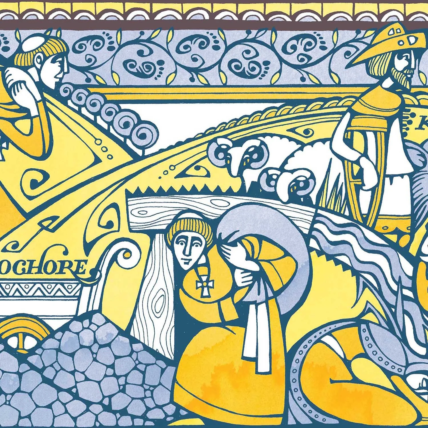
The map incorporates brand colours and symbols of pilgrimage, guiding walkers from the River Forth to St Andrews. Inspired by medieval texts, an illuminated border tells the story of the pilgrims who once travelled the path, marked by their distinctive hats, and badges collected at holy sites en route.

Client: Fife Coast & Countryside Trust

Illustrated map of Fife, Scotland by Jenny Proudfoot, describing its medieval history and modern tourist attractions. Drawn in pen & ink with a painted backdrop in teal and yellow corporate colours.
Coal mining detail from an illustrated map of Fife Pilgrim Way. Monks digging coal and longhorn sheep represent the region's industrial and agricultural heritage. In ornate ink and watercolor.
Country park detail from an illustrated map of Fife Pilgrim Way. Former mines at Lochore Meadows and St Ninian's transformed into nature reserves, havens for birds and butterflies. In ornate ink and watercolor.
Hiking detail from an illustrated map of Fife Pilgrim Way. A traveller walks the route through nature, historic Standing Stones and the modern town of Glenrothes. In decorative ink and watercolour.
Prayer detail from an illustrated map of Fife Pilgrim Way. The decorative border shows historic travellers worshiping Saint Margaret. In ink and watercolor.
Feasting detail from an illustrated map of Fife Pilgrim Way. The illuminated border shows medieval travellers dining. Drawn in pen & ink with watercolour.
Architecture detail from an illustrated map of Fife Pilgrim Way. Walkers approach the historic towns of Dunfermline, Inverkeithing and North Queensferry, featuring the three Forth Bridges. Hand-drawn ink, teal and yellow watercolor.
Previous
Previous

Scottish maps

Next
Next

Inky Bottles