SCOTTISH MAPS

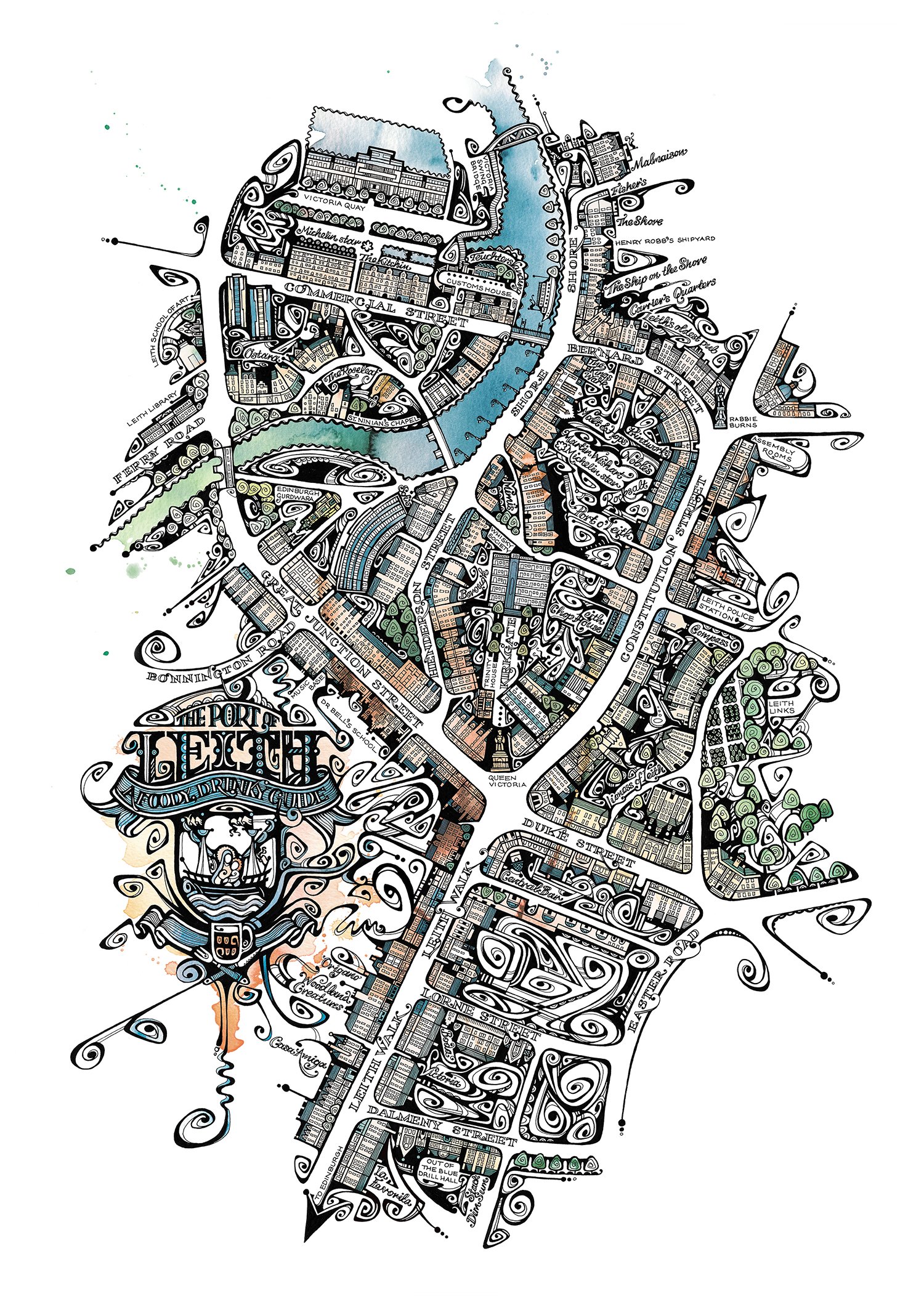
Decorative prints of Scotland, Edinburgh’s Old Town, South Queensferry and my home patch, Leith.

Self-published for retail

Illlustrated map of Scotland by Jenny Proudfoot. Rendered in ink and watercolour with hand lettering and an ornate crest. Includes Scottish wildlife, culture, architecture, food and characters including Robert Burns.
Decorative map of The Port of Leith in Edinburgh, Scotland, by Jenny Proudfoot. Illustrated in ink and watercolour with hand lettering and a decorative crest. Focussed on eating out and nightlife, featuring local landmarks, bars and restaurants.
Ornate illustrated map of Edinburgh's Old Town by Jenny Proudfoot. Drawn in ink and splashy watercolour with hand lettering and a decorative crest. Includes Edinburgh Castle, Holyrood Palace and The Scottish Parliament.
Hand-drawn map of South Queensferry, a coastal village in Scotland. In ink and splashy watercolour with hand lettering and a decorative crest. Illustration by Jenny Proudfoot.
Detail from my Edinburgh Old Town illustrated map. Featuring a coat of arms and decorative lettering.
Detail from an illustrated Scottish map. Drawn in ink with watercolor in a limited palate. Featuring castles and palaces, a seaside village, Dundee's V&A Museum and the mythological Kelpies.
Detail from my decorated map of Leith, Scotland. Featuring urban architecture, calligraphy and the local river, The Water of Leith.
Detail from an illuminated map of South Queensferry, a pretty town on the Scottish coast. With boats, beaches and architecture in ornamental ink and watercolour.
Detail from my decorated map of Leith, Scotland. With hand-drawn labels showing riverside pub, cafes restaurants and bars.
Detail from an ornamental map of Scotland, showing a hand drawn crest featuring the famous Duke of Wellington statue in Glasgow.
Next
Next

Fife Pilgrim Way